
Here is a map from the American Battlefield Trust of the battle upon East Cemetery Hill on the evening of July 2nd. However, we’re going to look across town on the afternoon of July 2nd using this map.
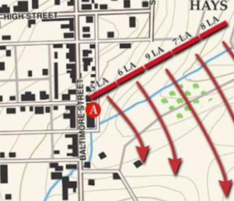
July 2nd between 7:30 to 9:30 p.m.
If we zoom into this map and look at High Street with “Wall Alley” being the next horizontal street just south of it. the map shows the location of the Langdon Hill House and the deployment line of the Louisiana Tigers under Hay’s Division. The Langdon Hill House is on the east side of Baltimore Pike (right) and just north of where the “5” is for the location of the 5th Louisiana regiment.
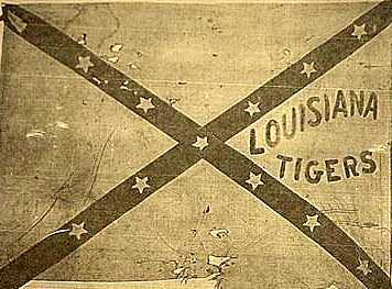
There is historical views of Louisiana Tigers entering homes along Baltimore Street on July 2nd and 3rd fighting with skirmishers of the Union Army near the Jennie Wade Museum and near the location of the Soldier’s National Cemetery. Some accounts have some soldiers of the “Tigers” entering the homes at the intersection South Street and Lever Street, near present-day Farnsworth House and Mr. G’s Ice Cream. Soldiers have been accounted for in the Langdon Hill House, the Harmon House, and the Garlach House. According to extensive research on the Langdon’s Hill House, some soldiers from the Louisiana Tigers were in the attic of their home and shooting out the windows. There is also blood on the floor boards upstairs.