Skip to content

Gettysburg Chronicles

History Explained

  • Home
  • Gettysburg
    • History of Adams County
    • Call to Arms
  • Tales to War
    • July 5th: Tillie Pierce Tale
    • 57th Pa.: Letter to Mother
    • 24th Mich.: Abel Peck
    • 24th Mich.: Charles Bellore
    • 1st Rifles: Colonel Taylor
  • Confederate
    • South Carolina
    • Mississippi Monuments
    • Florida’s Involvement
    • Spirit of Alabama
    • Georgia – The Peach State
    • Louisiana Secedes
    • Lonestar State
    • North Carolina
    • Virginia Secedes
    • Arkansas
    • Tennessee – Last to Join
    • Maryland – Border State
  • Union
    • First Shot Marker
    • Michigan Joins
      • 24th Michigan Joins Iron Brigade
      • 24th MI Prior to Fredericksburg
      • March to Gettysburg
      • Farnsworth’s Last Ride
      • “Come On You Wolverines”
  • Artillery
    • Different Ammunition
    • Real vs. Fake Cannons
    • Six Pound Shot Cannon
    • Cannons at Devil’s Den
  • Civil War Locations
    • Crampton’s Gap, Md.
    • Fox’s Gap, Md.
    • Turner’s Gap, Md.
    • Andersonville, Ga.
    • Navy – Hampton Roads, Va.
  • Photographs
  • Abraham Lincoln
    • Lincoln Visits Antietam
    • Emancipation Proclamation
    • John Wilkes Booth
    • The Kidnapping Plan
  • Anniversaries
    • Battlefield Walks
    • 150th Anniversary – 2013
    • 152nd Anniversary – 2015
    • 157th Anniversary – 2020
    • 158th Anniversary – 2021
    • 162nd Anniversary – 2025
  • Buildings
    • Local Churches
      • St. Francis Xavier Church
    • Sach’s Bridge
    • Weikert Family Farms
    • Farnsworth House
    • Soldier’s Orphanage
      • Brickyard Fight
      • 154th New York
      • Amos Humiston
      • Rosa Carmichael
    • Winebrenner History
    • Welty House
    • Cashtown
      • July 1863 in Cashtown
      • Cashtown: Since 1863
  • Families
    • Thorns
      • Evergreen Cemetery: August 1862 to June 1863
      • Gettysburg: June 26, 1863
      • Evergreen Gatehouse
      • Thorn’s Family Tree
      • Descendants of the Thorns
      • Aftermath of Battle
      • Thorn Important Locations
    • Wade Family
      • Thaddeus Filby
      • Rise of the Captain
      • Trouble with the Law
      • Jennie Wade
      • Newspaper Articles
      • Gravesites of Jennie Wade
      • Samuel and Harry Wade
      • James John “Jack” Wade
    • Georgia McClellan
      • Extended McClellan’s
      • Iowa Family – Lewis
      • World War II POW
      • Jennie Wade McClellan
      • Nellie McClellan
      • John McClellan
    • Jim B. McClellan
    • Pierce Lineage
      • McCurdy to Pierce Tree
      • James Shaw Pierce
      • William H. Pierce
    • Tillie Pierce
      • Last Week of June 1863
      • Tillie’s Accounts – July 1st
      • Wounded Everywhere
      • Hospital – Pierce House
    • Garlach Family
      • Soldier Hiding with Pigs
      • Anna Garlach
    • Shriver Family
      • Weikert’s Connection
      • Union Calvary Disaster
      • Father’s Death
      • Henrietta’s New Life
  • Railroads
    • G&H Railroad
    • Western Maryland Railroad
    • Location of the Spur
    • Gettysburg Electric Trolley
    • Trolley South of Town
    • Railroad to Round-Tops
  • Paranormal
    • Paranormal Equipment
    • Spirits at the Cashtown Inn
    • Pictures on the Bridge
    • Live: Sachs Covered Bridge
    • Haunted Orphanage
    • Spirits at the Farnsworth
    • Spirits at Tillie Pierce Inn
  • Questions
  • Toggle search form

Western Maryland Railroad Map

As of my research through 2025, there was just a general map that showed a possible spur between the Gettysburg and Harrisburg Railroad and the Western Maryland near Washington Street. Every historian knew it curved and approximated where the turn was. A recently found old drawn out and very detailed Western Maryland Train map shows exactly where the curve is and much more. Hopefully this map along with others will help historians of the Civil War Battle, the town of Gettysburg, and Western Maryland enthusiasts enjoy the history that is saved.

After some adjusting to make it more easier to view and to interpret, some colors have been added. Let’s dive into the map below.

The Red line from north to south on the map is Washington Street. The Blue line is the path of Steven’s Run through the western portions of town. The Yellow box is the current and former location of the Gettysburg and Harrisburg Train Station that was built in the 1880s along Washington Street. I didn’t highlight it, but it also shows the platform for the station for both sets of tracks north and south of the station. The Orange box is the location of the former Gettysburg Ice and Storage Company. Multiple buildings within the “Ice House Complex” are still along the railroad tracks and are used by Gettysburg college students.

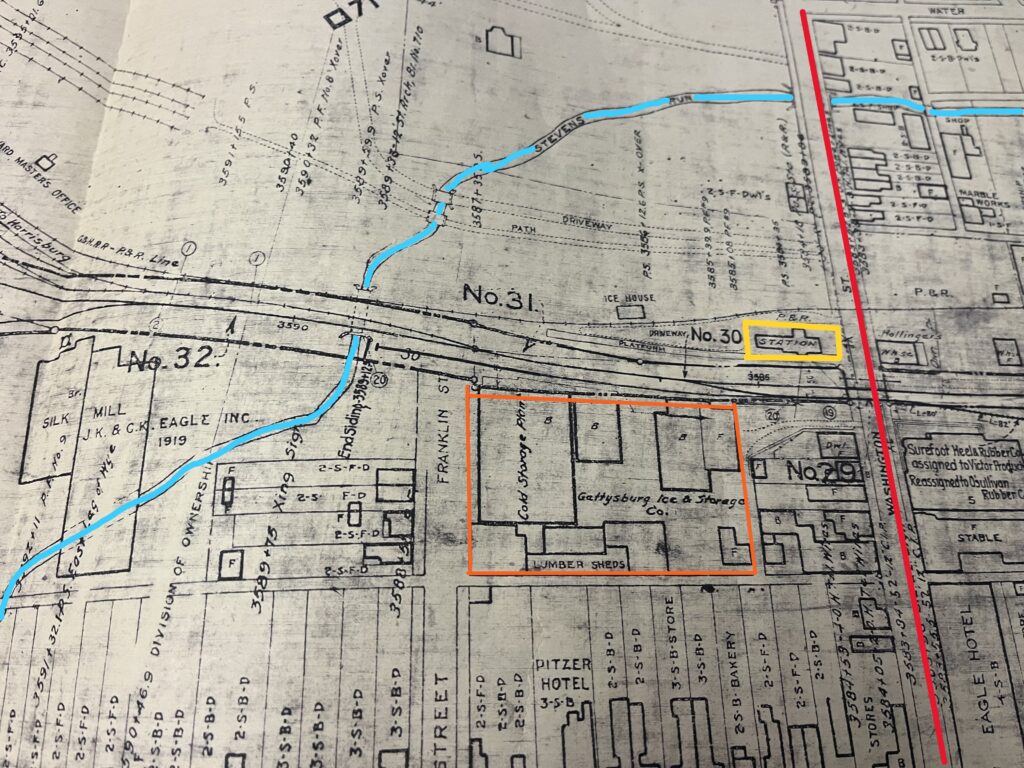
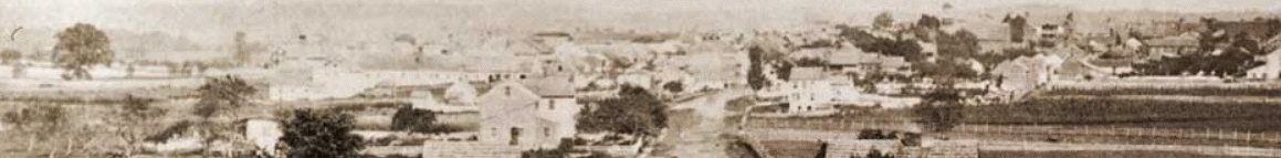
First off, notice the amount of detail on this Western Maryland Railroad map of the western portions of downtown Gettysburg back in the early 1900s. Whomever did this map looked into different parcels and property lines across town, added in roads, avenues, and alleys, Steven’s Run, and added in multiple lines of the railroad. The building in the far bottom right shows the location of the former Eagles Hotel, which is now the current location of the Seven-Eleven.

Since my knowledge of Gettysburg since 2000, there is one set of railroad tracks that crosses at Washington Street. A siding is in front of the North Washington Street station, but doesn’t cross the road. In this map below from 1919, it shows at least four different lines, possibly five, that cross the street. Just imagine the amount of locomotives, freight, livestock, and coal cars and the stench of the smells coming from all the moving machines moving near this area during this time period.

@ 2026 Gettysburg Chronicles

Powered by PressBook WordPress theme