The United States of America is celebrating its 250th year anniversary of existence in 2026, due to the signing of the Declaration of Independence that occurred in 1776. However, across the frontier, towns and small communities were already developed and bustling with trade goods and rations. Some areas of the state of Pennsylvania have been lived on by settlers from Europe, England, and Ireland since the late 1600s. Let’s look into the brief history of how settlers began on the frontier and one main community that was here prior to the civil war.
William Penn was a Quaker that was given a royal land grant by Charles II of England in 1681. He arrived from England and founded the province of Pennsylvania, a British North American colony. A settler named John Hanson Steelman possibly became the first settler of Adams County around 1718 near what is now Carroll Valley and Fairfield area. Mr. Steelman was an Indiana trader and an interpreter. During this time, North American Indian tribes called the Six Nations were on the frontier and had small encounters with new settlers invading their lands.
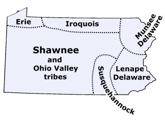
These areas deciphered by this map above shows the approximate area they lived in. Across southern Pennsylvania, Shawnee, Ohio Valley Tribes, Susquehannock, and the Lenape/Delaware were mainly avoiding trappers and settlers that were moving onto their lands. As more German, Irish, Dutch, British, and Quaker settlers moved westward, an Indian and settler meeting was needed so that peace could be achieved between settlers and Indians.
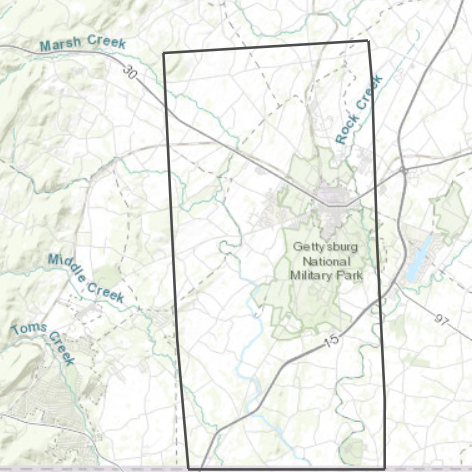
In 1736, after the signing of the treaty in Philadelphia between Thomas Penn and the members of the Six Nations, settlers began moving into the area peacefully. One of the first churches in the area was in the Lower Marsh Creek Presbyterian Church that was organized in 1748. Settlers had to overcome the French and Indian war that occurred between 1754 and 1758. In 1764, a settler by the name of John Frankenberger purchased some land from Thomas Penn near what is now East Berlin, Pennsylvania. William Penn and Thomas Penn surveyed southern Pennsylvania in 1766 and created the “Manor of Maske” that was the area of 6 miles by 12 miles. This map below shows the diagram of where the second largest estate was within Pennsylvania. The Manor of Maske does not include the small towns of Fairfield and Cashtown, which is about 7 miles apart.
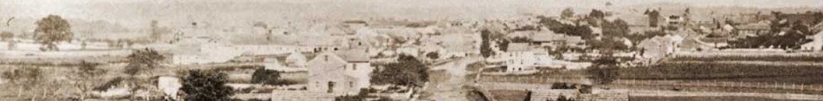
Prior to the Manor of Maske, a settler from Ireland arrived into the Marsh Creek settlement around 1740. Around this same time, there was between 100 to 200 settlers within the region farming and working at flour and grist mills, and working as blacksmiths along dirt roads. Log cabins, stores, and mills would be along these roads, along with taverns for people to eat and drink at. One of these settlers, named Samuel Gettys, would obtain a tavern and a few hundred acres of land. However, Samuel Gettys debt got the best of him during the American Revolution and he was ordered by the courts to sell some of the acreage. His son, James Gettys, bought back some of the land and laid a design for a town. From this, Samuel and James Gettys hard work and understanding of the region officially formed the town of Gettysburg on January 10, 1786.
The county of Adams was formed a few years later after York County divided the lands. The county of Adams was created on January 22, 1800.
Happy 226th birthday to Adams County!